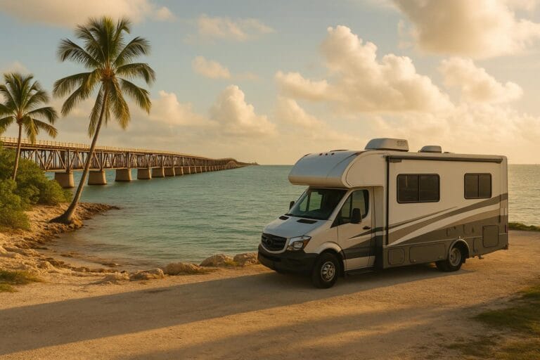
Best Scenic RV Routes in the American Southwest
From red-rock cathedrals to high desert horizons, the American Southwest delivers some of the world’s most unforgettable road scenery—and it’s tailor-made for RV travelers. Whether you usually explore Europe’s alpine passes or Mediterranean coastlines, these routes match that sense of drama with big skies, ancient geology, and wide-open space. Below you’ll find realistic drive times for RVs, campground and boondocking ideas, and seasonal weather advice so you can plan with confidence.
Utah Scenic Byway 12: Bryce Canyon to Capitol Reef
Utah’s Highway 12 is a bucket-list byway linking Bryce Canyon National Park to Capitol Reef via Kodachrome Basin, Escalante, and Boulder Mountain. It’s 122 miles of stone amphitheaters, slickrock waves, and forested summits.
RV time estimate: 4.5–6 hours without long hikes. Expect slower stretches and frequent pullouts for photos. The famed Hogback—a narrow ridge with steep drop-offs—demands attentive driving but is paved and passable for most RVs in good weather.
Highlights:
- Bryce Canyon’s hoodoos at sunrise
- Lower Calf Creek Falls hike (RV-friendly parking fills early)
- Boulder Mountain viewpoints above 9,000 feet
Campgrounds:
- North Campground (Bryce Canyon NP) and nearby Ruby’s RV Park
- Kodachrome Basin State Park (spacious RV sites, dark skies)
- Escalante Petrified Forest State Park (lake views)
- Fruita Campground (Capitol Reef; book well in advance)
Boondocking ideas:
- BLM sites off Hole-in-the-Rock Road (washboards; avoid after heavy rain)
- Dispersed camping along forest roads near Boulder Mountain when snow-free
Seasonal notes: Late spring to early fall is best. Summer monsoons (July–Sept) can cause flash floods on dirt spurs. Winter brings snow and occasional closures at higher elevations.
Arizona’s Route 66 Detours: Flagstaff to Kingman and the Oatman Twist
Mother Road nostalgia meets desert drama along this classic corridor, with detours that showcase the best of northern Arizona.
RV time estimate:
- Flagstaff to Seligman: ~75 miles; 1.5–2 hours
- Seligman to Kingman (historic 66): ~87 miles; 2–2.5 hours
- Kingman to Oatman via Sitgreaves Pass: ~28 miles; 1–1.5 hours (steep, narrow)
Highlights:
- Williams and Seligman’s Route 66 storefronts and diners
- Detour to the Grand Canyon South Rim from Williams (allow a full day)
- Oatman’s burros and mountain curves over Sitgreaves Pass
RV cautions: The Oatman segment is steep and narrow with tight curves—large Class A rigs and long trailers are not recommended. Consider making Oatman a day trip in a toad or smaller vehicle.
Campgrounds:
- Williams KOA and Kaibab Lake (USFS) for pine shade
- Kingman’s Fort Beale RV Park for in-town convenience
Boondocking ideas:
- Kaibab National Forest dispersed sites near Williams and Tusayan (check fire restrictions)
- Cerbat Foothills BLM near Kingman (verify current access)
Seasonal notes: Flagstaff/Williams see winter snow; spring and fall are ideal. Desert segments can exceed 100°F in summer—start early, carry extra water, and watch tire pressures.
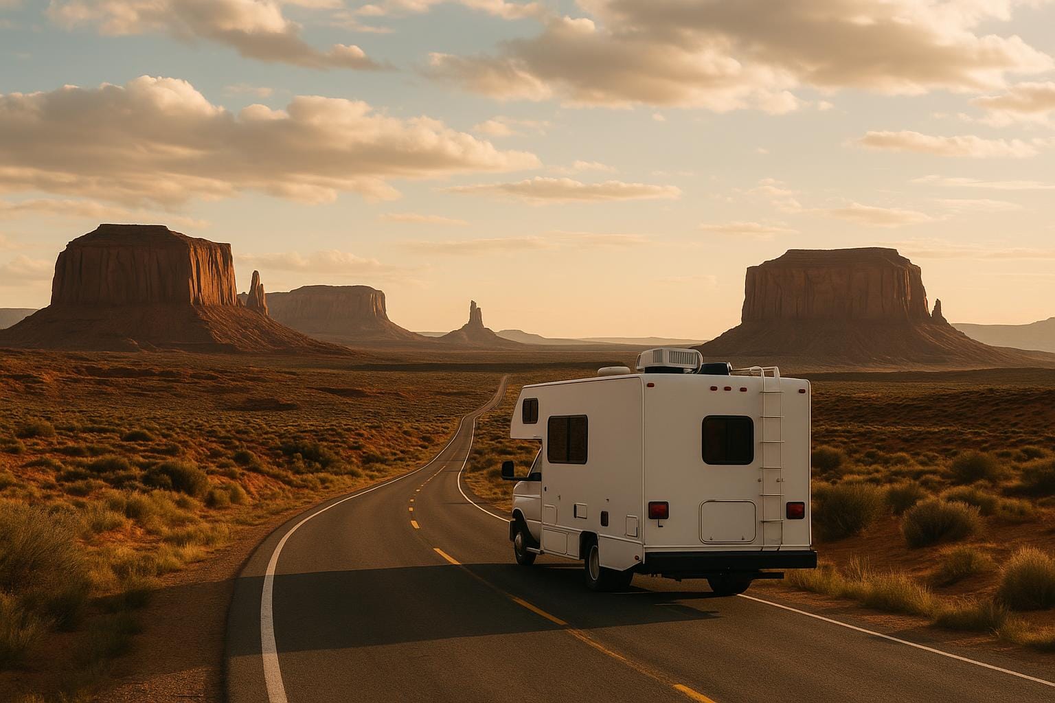
Monument Valley and Valley of the Gods: Iconic Buttes and Big Skies
US-163 from Bluff to Monument Valley delivers that famous horizon of sandstone buttes—an American road-trip icon with sparse services and endless views.
RV time estimate:
- Bluff to Monument Valley Tribal Park: ~47 miles; 1–1.5 hours
- Valley of the Gods Road (17-mile dirt loop): 1.5–3 hours in high-clearance rigs; not for low-clearance or after heavy rain
Important: The Monument Valley Tribal Park’s interior 17-mile scenic drive is rough; many large RVs are not suitable. Consider guided tours or use a toad.
Campgrounds:
- Goulding’s RV & Campground (full hookups, views)
- The View Campground (premium vistas; limited space)
- Goosenecks State Park (primitive rim sites; unreal sunsets)
Boondocking ideas:
- Valley of the Gods dispersed BLM camping (check road conditions and weather)
- Sand Island BLM near Bluff
Road caution: Moki Dugway (UT-261) is a steep gravel set of switchbacks—not recommended for large RVs. Use paved alternatives via US-163 and US-191.
Seasonal notes: Wind can be fierce in spring; summer monsoons bring quick-moving storms and flash floods on dirt. Winter nights are frigid but crowd-free.
New Mexico’s Turquoise Trail (plus the Enchanted Circle)
Between Albuquerque and Santa Fe, NM-14 meanders through old mining towns and art communities, then northern New Mexico’s mountains complete the picture.
RV time estimate:
- Turquoise Trail (Albuquerque to Santa Fe via NM-14): ~50–65 miles; 1.5–2.5 hours with stops in Madrid and Cerrillos
- Enchanted Circle (Taos, Red River, Eagle Nest): 83-mile loop; 3–5 hours due to grades and viewpoints
Highlights:
- Madrid’s galleries and colorful facades
- Santa Fe’s Pueblo-style architecture and cuisine
- High meadows and elk country around Eagle Nest
Campgrounds:
- Santa Fe Skies RV Park (sunset views, easy access)
- Cochiti Lake (COE; roomy sites and starry nights)
- Taos-area private parks for Enchanted Circle staging
Boondocking ideas:
- Caja del Rio (SFNF) dispersed areas west of Santa Fe—check road conditions
- Carson National Forest dispersed sites near Taos, when snow-free
Seasonal notes: Altitude matters here—Santa Fe sits around 7,000 feet. Expect cool nights even in summer, afternoon thunderstorms July–Sept, and snow November through March.
Zion Country via US-89: Kanab, Page, and Tunnel Tips
The US-89 corridor threads slot canyons, cliffs, and lake country between Page, Kanab, and Zion National Park. It’s a flexible, photogenic route with key RV considerations.
RV time estimate:
- Page to Kanab: ~74 miles; 1.5–2 hours
- Kanab to Springdale (Zion) via UT-9 and the east entrance tunnel: ~42 miles; 1.5–2.5 hours depending on traffic and tunnel escorts
Important: The Zion–Mt. Carmel Tunnel has size restrictions and requires a paid escort for many RVs. If your rig exceeds limits or you’d rather avoid the tunnel, approach Zion via I-15 to Springdale, or base in Hurricane/La Verkin and day-trip in a smaller vehicle.
Highlights:
- Horseshoe Bend and Glen Canyon near Page
- Kanab’s slot canyon trailheads
- Zion’s canyon walls and riverside paths
Campgrounds:
- Watchman and South Campground (Zion; book early)
- Zion Ponderosa (east side; roomy sites, activities)
- Kanab RV parks for a central base
Boondocking ideas:
- Sheep Bridge Road and Smithsonian Butte (BLM near Virgin/Springdale; check closures)
- House Rock Valley Road near the Arizona border—deep sand when wet
- Lone Rock Beach (primitive lakeside camping; soft sand)
Seasonal notes: Spring and fall offer mild temperatures and lighter crowds. Summer heat is intense; plan hikes early. Winter can bring ice on shady roads, but crowd levels drop.
Sedona and the Verde Valley: Red Rocks the RV-Friendly Way
Those crimson cliffs and juniper-dotted mesas are irresistible—but Sedona’s narrow canyons and steep grades reward a thoughtful RV plan.
RV time estimate:
- Flagstaff to Sedona via AZ-89A through Oak Creek Canyon: 28 miles; 1–1.5 hours in small rigs
- Large rigs should use I-17 to SR-179, then day-trip 89A in a toad
Highlights:
- Chapel of the Holy Cross and red rock viewpoints
- Historic Jerome perched on Cleopatra Hill (steep, tight streets)
- Wine tasting and birding in Cottonwood and Clarkdale
Campgrounds:
- Dead Horse Ranch State Park (Cottonwood; roomy, central)
- Rancho Sedona RV Park (shaded, near town; tighter sites)
- Distant Drums RV Resort (Camp Verde; easy big-rig access)
Boondocking ideas:
- Coconino NF Forest Road 525 and nearby spurs west of Sedona (closures vary; respect posted signs)
- Dispersed sites near Cottonwood and Flagstaff on designated forest roads
Seasonal notes: Spring and fall bring ideal temps and heavy demand—book early. Summer monsoons can produce fast-moving storms; winter sees occasional snow, quickly melting in town.
Practical Tips for European Travelers in the Southwest
Distances are larger than they look on the map, and services can be far apart. Build buffer time and fuel up when you can.
- Driving pace: Plan 35–45 mph averages on scenic byways with frequent pullouts.
- Length limits: Check tunnel/grade restrictions (Zion tunnel, Oatman, Oak Creek Canyon) before committing.
- Weather strategy: Start early in summer, watch monsoon forecasts, and avoid clay roads after rain.
- Permits and passes: The America the Beautiful pass is excellent value for multiple parks.
- Boondocking etiquette: Camp on durable surfaces, pack out all waste, and observe local fire bans.
Key Takeaways
- Utah’s Highway 12 and Arizona’s Route 66 provide iconic scenery with RV-friendly segments—plan for slower, photo-heavy days.
- Know your rig’s limits: Avoid Moki Dugway, Sitgreaves Pass to Oatman, and Oak Creek Canyon in big Class A setups.
- Mix campgrounds with strategic boondocking on BLM and USFS lands for flexibility and starry skies.
- Seasonality matters: summer heat and monsoon storms, winter snow at altitude—pack layers and check road reports.
Conclusion
If your heart beats faster for cinematic horizons, the American Southwest belongs on your RV shortlist. String together Highway 12’s hoodoos, Route 66’s retro charm, Monument Valley’s silhouettes, New Mexico’s artsy byways, and Zion’s canyon walls for a loop that rivals Europe’s grandest drives. With smart pacing, a weather eye, and a few well-chosen camps, you’ll turn the map’s empty spaces into your favorite memories.